GIS – QGIS – enables you to look at finds from a macro (the individual item) to the macro (the wider site) level and even inter-site level. e.g. other local sites of a similar nature. Click here for a general overview of what GIS is.
This link is to a web site that looks at the conceptual background to landscape, afterall – that is what we are looking at. Whether a spot in a field to the buildings, trees, lanes, hedges around is in the horizon.
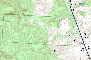
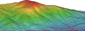
To help learn about the potential for GIS in NWAG, we can use several of the sites investigated as examples. Let us start with Bayton and Winall Mill.
Resources:
A very good site for learning about digital maps and GIS work is EDINA Digimap where they have published videos and data to accompany their workshops.
Citations: